


In conversations about Israel – whether political, historical, or religious – one critical factor often goes unexamined: geography. The physical landscape of this small but astonishingly diverse country has shaped everything from ancient migration patterns to modern strategic concerns. Yet, without an understanding of its topography, many discussions lack the full picture.
A Land of Dramatic Contrasts
For a country roughly the size of New Jersey, Israel packs a striking geographic punch. It stretches from the snowy peaks of Mount Hermon in the north to the sun-soaked shores of the Red Sea in the south, with everything from fertile valleys to arid deserts in between. This diversity isn’t just beautiful – it has profound historical and strategic implications.
Consider the sharp climatic divide created by the Judean Mountains. Jerusalem, perched on these highlands, experiences cool winters and occasional snowfall, while just a short drive to the east, the Dead Sea region swelters in one of the hottest, driest places on Earth. This stark difference is the result of a rain shadow effect, where the mountains block moisture-laden air from the Mediterranean, creating a parched desert landscape on their eastern slopes.
These elevation changes have shaped human history for millennia. They explain why ancient trade routes followed certain paths, why some cities thrived as centers of commerce while others struggled, and why control of specific highlands remains strategically crucial even today.
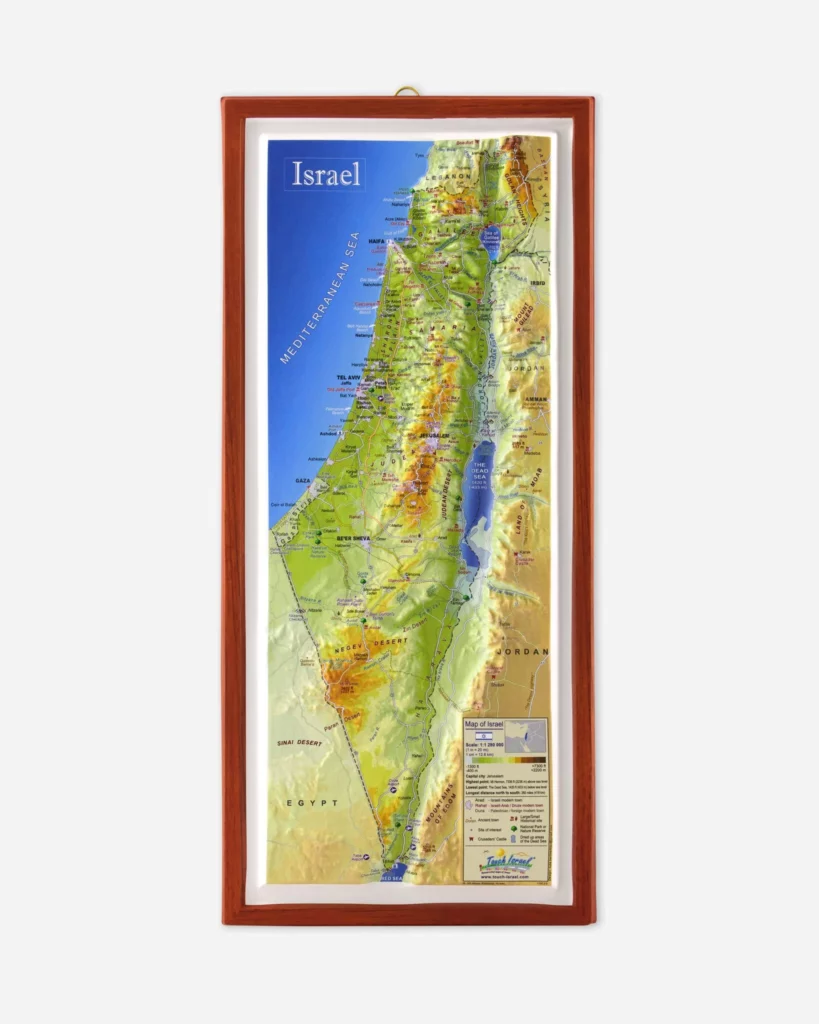
For those who want to truly grasp these connections, having a tactile, three-dimensional representation of the land can be transformative. Israel365 offers two unique types of 3D maps to help you do just that – the 3D Map of Modern Israel, which captures the landscapes and political realities of the present-day country, and the 3D Map of Biblical Israel, which brings the ancient world to life, highlighting the places and journeys described in the Bible.
These maps allow you to trace the peaks and valleys that shaped ancient armies’ movements, follow the rivers that sustained early settlements, and appreciate the strategic highlands that remain relevant today.
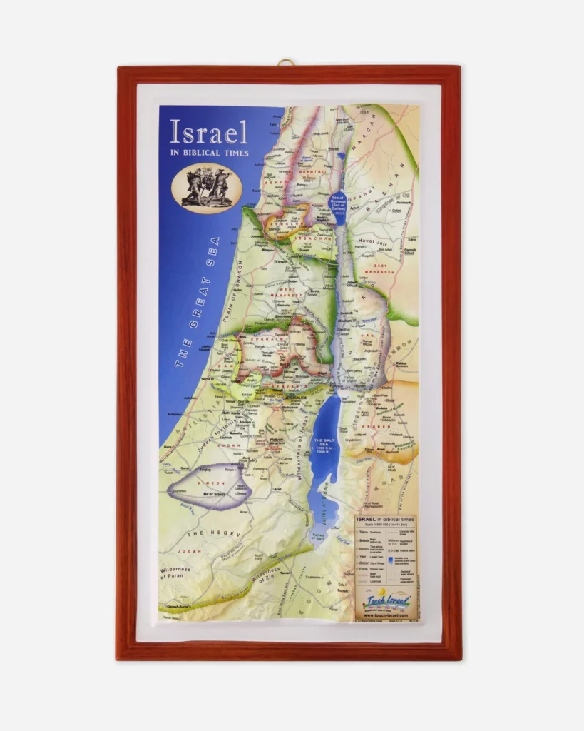
Reading Biblical Narratives Through Topography
Understanding the geography of Israel also deepens our appreciation for its religious and historical texts. For instance, the limestone wilderness of the Judean Desert provided countless hiding places for David as he fled from Saul – a detail that becomes far more tangible when you know the terrain. The prophets’ warnings about trusting in foreign powers like Egypt also take on new meaning when you consider the vulnerability of trade routes that armies used to march through the region.
Having a physical map on hand, like our 3D maps of Modern and Biblical Israel, can make these connections come alive, providing context for the journeys and struggles described in these ancient texts.
Modern Israel: Geography and Security
Today, geography still shapes the political landscape. The Golan Heights, a volcanic plateau overlooking northern Israel, remains a strategic high ground, offering a critical line of defense. Similarly, the West Bank’s rugged highlands directly overlook Israel’s narrow coastal plain – a geographical reality that has shaped decades of political and military strategy.
Water is another critical issue. Israel’s narrow waist – just nine miles wide near Netanya – and the scarcity of freshwater sources like the Jordan River and the Sea of Galilee have driven innovative approaches to agriculture and water management, reflecting the challenges of living in this arid part of the world.
For those who want a deeper, more tactile understanding of these challenges, an 3D map of Israel – whether focused on the modern landscape or the biblical world – can be an invaluable tool, offering a perspective that no screen can match.
Cultural Landscapes Shaped by Geography
Geography also shapes the cultural fabric of the country. The bustling, modern city of Tel Aviv, with its Mediterranean coastline and cosmopolitan vibe, stands in sharp contrast to the ancient, spiritual atmosphere of Jerusalem. Agricultural settlements in the Galilee, desert communities in the Negev, and the dense urban centers along the coast all reflect the diverse landscapes in which they developed.
For anyone looking to understand Israel – whether through the lens of religion, politics, or culture – a foundational grasp of its geography is essential. In a land where every hill and valley holds historical and symbolic weight, understanding the lay of the land isn’t just helpful – it’s crucial for meaningful engagement with one of the world’s most historically rich and contested regions. And for those wanting to truly explore this landscape, having a 3D map of Israel – whether of Modern or Biblical Israel – can turn abstract names and places into a vivid, tangible reality.