


For 26 years, the Litani River served as a red line. Israel had last crossed it in 1982. Now, Israeli forces have pushed beyond it again, not out of ambition, but because every diplomatic mechanism designed to prevent this moment failed completely.
The Ceasefire That Was Never a Ceasefire
UN Resolution 1701, which ended the 2006 Israel-Hezbollah war, required Hezbollah to withdraw north of the Litani River. Hezbollah never complied. UNIFIL failed to enforce it. The Lebanese government failed to enforce it. The international community failed to enforce it. For nearly two decades, Hezbollah, with Iranian patronage, transformed southern Lebanon into a missile arsenal pointed at Israeli homes, schools, and cities.
Israel’s UN envoy, Danny Danon, stated plainly: “The real discussion in the Security Council should be about the ongoing failure to implement UN Security Council Resolution 1701. For years, Hezbollah has flagrantly violated UN resolutions, armed itself under Iran’s patronage, and posed a direct threat to Israeli civilians and to regional stability.”
By Masser via Wikipedia
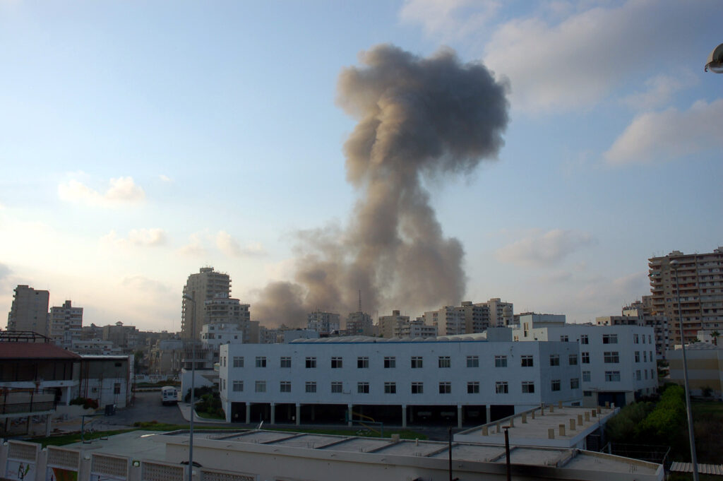
Israel’s crossing of the Litani comes after months of relentless Hezbollah fire from southern Lebanon. Since March 2, when Hezbollah launched attacks on northern Israel two days after U.S.-Israeli strikes on Iran, the terror group’s principal backer, the group has fired roughly 5,500 rockets at IDF troops operating in southern Lebanon and another 2,500 into Israeli territory, with at least 75 impact sites recorded inside Israel. Hezbollah has also launched around 300 drones, 25 of which struck Israeli soil.
An ostensible ceasefire was announced on April 16. It has since eroded dramatically. Twenty-five Israeli soldiers have been killed since hostilities resumed on March 2, including Staff Sgt. Michael Tyukin, 21, of the Givati Brigade’s Reconnaissance Unit, who was killed Saturday night when a Hezbollah first-person view drone equipped with night-vision struck his position near Zawtar al-Sharqiyah.
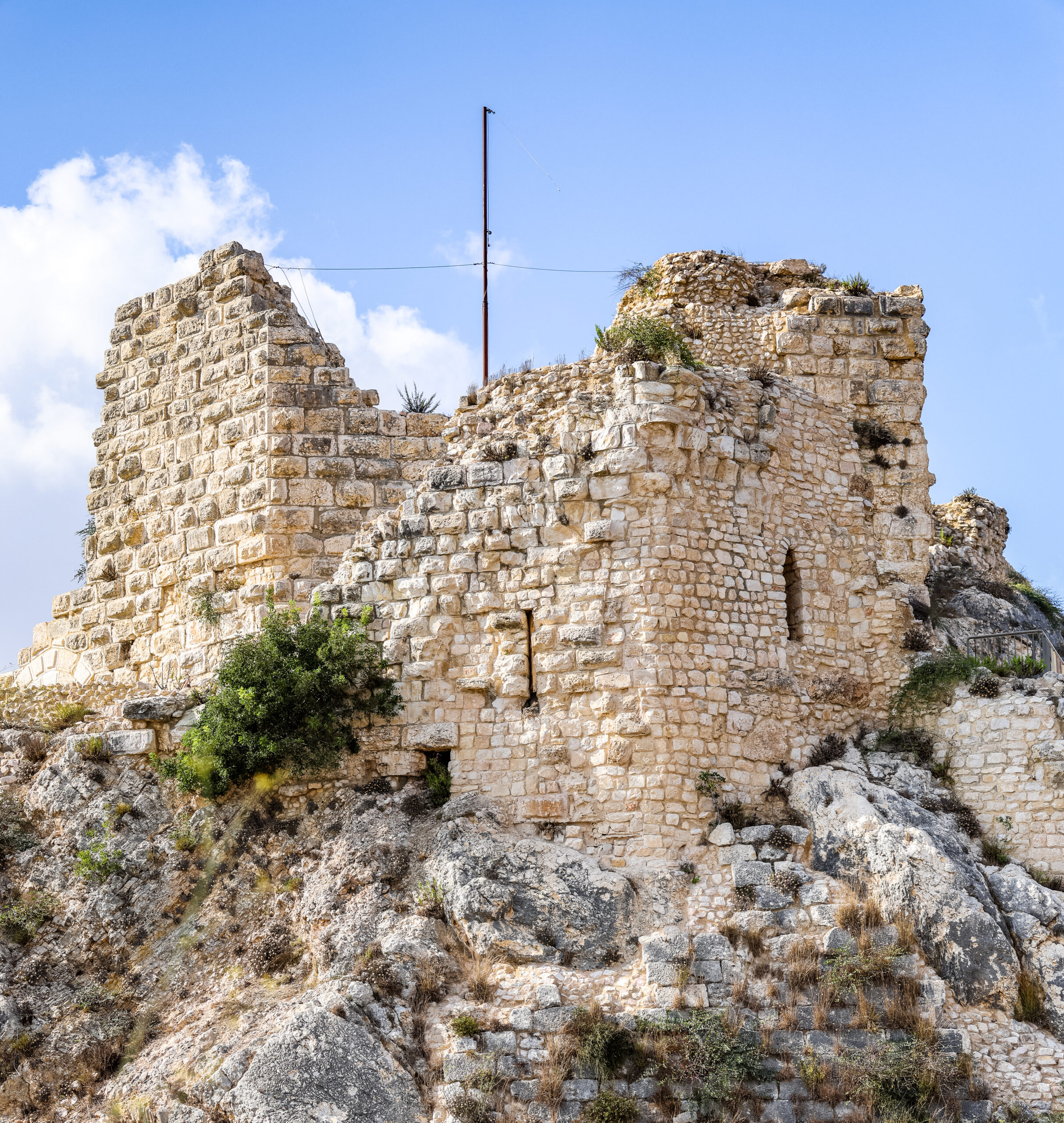
The Castle on the Ridge
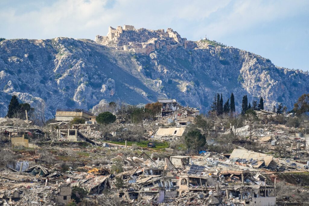
The IDF’s advance into southern Lebanon culminated Sunday with Israeli and IDF flags flying over Beaufort Castle, Qalaat al-Shakif, a medieval Crusader-built fortress perched on a commanding ridge approximately five kilometers from the Israeli border. The fortress commands sweeping views of the Galilee panhandle in northern Israel and the Nabatieh area in southern Lebanon. The IDF announced it had launched ground operations in the Beaufort Ridge and Wadi Saluki stream area to “destroy Hezbollah infrastructure and eliminate terrorists, as part of strengthening operational control in southern Lebanon and removing the direct threat to the Galilee Panhandle and Metula.”
Israeli troops first captured Beaufort in June 1982 during the First Lebanon War. This week, the same Golani Brigade returned to the site, where it had once fought PLO terrorists, killing dozens at the cost of six Israeli soldiers. Israel held the fortress throughout its 18-year presence in southern Lebanon before withdrawing in 2000.
“Forty-four years after the heroic Battle of the Beaufort, and on the memorial day for the Peace for the Galilee War, including the Golani soldiers who fell in the Battle of the Beaufort, IDF soldiers, led by the Golani Brigade, returned to the summit of Beaufort and once again raised the Israeli flag and the Golani flag there,” Defense Minister Katz said.
Prime Minister Benjamin Netanyahu called the capture “a dramatic stage and a dramatic shift in the policy we are leading,” adding: “Now my directive is to deepen and expand our hold on areas that had been under Hezbollah’s control.” He noted that Israel has eliminated 8,000 Hezbollah terrorists since the group began attacking Israel after the Hamas-led October 7 massacre, including 700 in the past month alone.
Katz vowed troops would remain at Beaufort “as part of the security zone in Lebanon,” delivering a direct message to Israel’s enemies: “Whoever threatens the citizens of Israel will lose their strategic assets one after another.”
A Border Drawn by Foreigners, Paid for in Blood
The current Israeli-Lebanese border is not a product of geography, history, or the will of the people who live there. It is a product of the 1916 Sykes-Picot Agreement, a secret wartime deal between Britain and France that carved up the collapsed Ottoman Empire in accordance with European imperial interests. The line was drawn with no regard for geographic features, historical precedents, or ethnic and religious realities. The consequences have been catastrophic: a century of instability, war, and unresolved conflict across the entire Middle East that persists to this day.
The natural geographic boundary between the Galil and the Lebanese mountain region was never the line diplomats drew. It was always the Litani River.
Ben-Gurion Understood What We Are Relearning in Blood
More than a century ago, in 1918, before Israel existed, when the Ottoman Empire had just collapsed, and foreign powers were redrawing the map, David Ben-Gurion wrote a remarkable essay: Gvul artzeinu v’admatah, “The Borders of Our Land and Its Territory.”
Ben-Gurion’s answer to the question of Israel’s natural borders was not political. It was geographic, historical, and strategic. He identified the Mediterranean Sea to the west, the Syrian Desert to the east, the Sinai Peninsula to the south, and the Litani River as the natural northern border of the Land of Israel. South of the Litani, the terrain, infrastructure, and population patterns belong to the Galil. North of it, the Lebanese mountain region begins. Ben-Gurion was describing a reality that Israel is now relearning through war.
As Dr. Omri Abadi, a lecturer of archaeology and history at the Hebrew University in Jerusalem, has documented, southern Lebanon was the territory of the biblical tribes of Asher and Naftali. The tribe of Asher was allocated southern Lebanon from Sidon to Mount Lebanon. Ruins from the centuries of Asher‘s presence are scattered throughout the region. Because Arab place names frequently preserved the ancient Hebrew originals, scholars can trace the approximate locations of Israelite villages that stood there three millennia ago.
The Jews of Hasbaya in southern Lebanon, for instance, lived there for hundreds of years before relocating to Rosh Pina approximately 130 years ago, when Baron Rothschild established a silk factory there. Jewish presence in these lands was not ancient mythology; it was living history that persisted until the modern era.
What Moses Saw and What God Promised
The connection between Israel and southern Lebanon, including what lies north of the Litani, is written into the very text of the Torah itself.
In Deuteronomy 3:23-25, Moses pleads with God:
“I besought the LORD at that time, saying: O LORD God, You have begun to show Your servant Your greatness and Your mighty hand… Let me, I pray, cross over and see the good land that is on the other side of the Jordan, that good hill country, and the Lebanon.” (Deuteronomy 3:23-25)
Professor Dr. Yoel Elitzur, one of Israel’s foremost scholars of biblical geography and author of the foundational work Places in the Parasha, explains the significance of what Moses was longing to see:
“Moses makes a pleading request to be permitted to see a very specific location: Mount Lebanon in the far north of the land. Moses longs to see Mount Lebanon, a site that, in his eyes, represents the very epicenter of the beauty of the land of Israel.
“We see this again in the list of the borders of the Promised Land at the end of Parashat Ekev: ‘Your territory shall extend from the wilderness to the Lebanon and from the river – the Euphrates – to the Western Sea’ (11:24). As we discussed earlier, the Torah contains two sets of borders for the Holy Land, one limited and one expansive. The expansive set of borders reaches north until the Euphrates, while the limited set of borders reaches only to the northern Mount Hor and Lebo-hamath. The expansive border is the ideal permanent border for the land of Israel, intended for later generations to realize after the nation’s population was to expand. In contrast, the limited border is the nucleus of the land of Israel, designated for the first stage of the conquest. For our discussion here, it is important to stress that the Lebanon was included even within the initial, limited set of borders. We can see this, first of all, from our parasha, where Moses is located in the very heart of the spacious Promised Land, and requests to see the Lebanon.
“In the language of the Tanakh, the Lebanon refers first and foremost to the tall Mount Lebanon range, which bears this name until today. However, it occasionally refers to the Beqaa Valley (Valley of the Lebanon) east of the range, and in certain cases it even refers to the mountain range known today as the Anti-Lebanon mountains on the east, opposite Mount Lebanon.”
Prof. Elitzur further notes that whenever a definite article, the Hebrew letter hey meaning “the,” precedes a place name in the Torah, it signals that the location is part of the divinely intended Land of Israel. “The Lebanon,” HaLevanon, carries that definite article throughout the biblical text.
God’s promise to Joshua was unambiguous: “I Myself will dispossess those nations for the Israelites.”
The Christian Connection to Southern Lebanon
Southern Lebanon is not only woven into Jewish biblical history, but it holds deep significance for Christians as well. The Gospels record Jesus traveling to the region of Tyre and Sidon, where He encountered the Syrophoenician woman who pleaded for her daughter’s healing (Mark 7:24-30). This places southern Lebanon directly within the lived geography of Jesus’s ministry. Local Christian tradition in the village of Maghdouche holds that the Virgin Mary waited there while Jesus preached in nearby Tyre and Sidon, a memory kept alive today at the shrine of Our Lady of Mantara. Further south, the village of Qana is identified by Lebanese Christian tradition as the site of the wedding feast at Cana, where Jesus performed His first miracle, turning water into wine, though the Gospel of John places Cana in the Galilee, and scholars continue to debate the precise location. For centuries, Christian communities put down deep roots across this region, building churches, monasteries, and shrines that still stand amid the rubble of war. The land that Hezbollah turned into a missile base was, for much of its history, a landscape saturated with Christian memory and presence.
History Is Returning to Its Source
The UN Security Council has called an emergency session. France’s President Emmanuel Macron has declared that “nothing justifies the major escalation underway in south Lebanon.” The same international community that watched Hezbollah arm itself for two decades under UN observation, that failed to enforce Resolution 1701, that did nothing while thousands of rockets rained down on Israeli cities, now demands Israel stop.
Israel’s soldiers are standing on Beaufort Castle. The Galil stretches out below them. The border that the Sykes-Picot Agreement imposed, born of European imperial ambition, has cost a century of blood. The border that Moses longed to see, that Ben-Gurion identified as the only defensible line, that Asher and Naftali once called home, is the Litani River.
Netanyahu said it plainly: “We have broken through the barrier of fear. We are taking the initiative.”

