


The Roman Empire’s road network stretched far beyond what historians knew. A groundbreaking digital atlas published Thursday reveals that ancient Roman roads extended nearly 186,000 miles across their empire—50 percent longer than the 117,163 miles previously documented. The discovery rewrites our understanding of Roman infrastructure and its lasting impact on regions including ancient Judea, where these engineering marvels shaped commerce, communication, and the movement of people for centuries.
The last comprehensive atlas of Roman road networks appeared 25 years ago. Since then, satellite imagery, aerial photography from World War II planes, and advanced archaeological techniques have unlocked what earlier researchers missed. Over five years, archaeologists examined historical records, ancient journals, and milestone locations, then scoured terrain from above for subtle clues—vegetation patterns, soil variations, raised mounds, and cut hillsides—that marked where Roman lanes once ran.
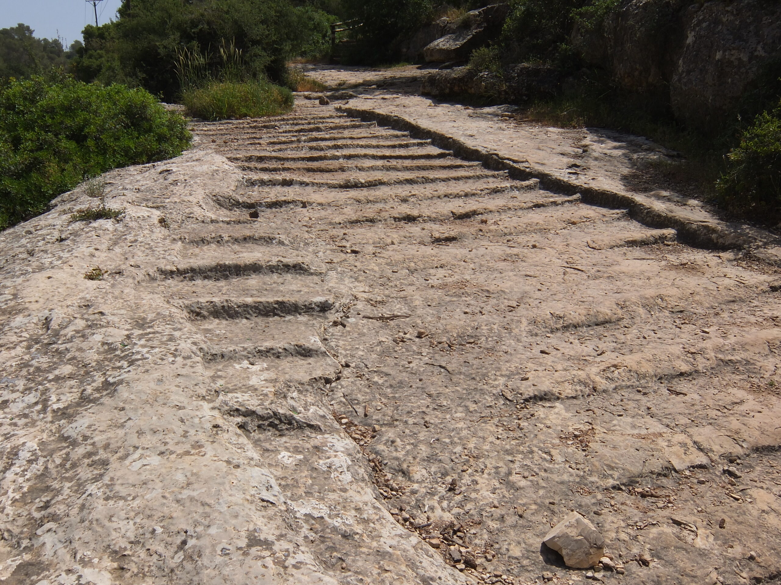
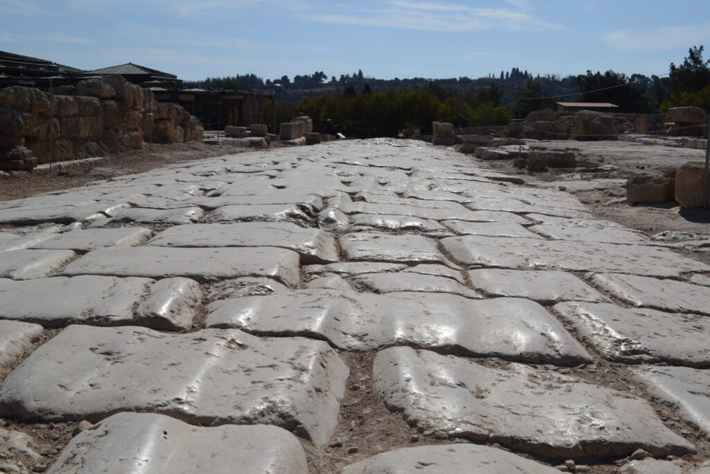
The Talmud in Avodah Zarah offers a striking perspective. When discussing Rome’s legacy, the Sages acknowledged that Rome built markets, bathhouses, and roads throughout the land. This infrastructure connected cities and villages, enabled trade, and made travel across vast distances possible. The Romans constructed their roads with remarkable precision, using layered stone and gravel that allowed merchants, soldiers, and pilgrims to traverse the region efficiently.
In the end-of-days scenario described in the Talmud, Rome argues that it deserves a portion in paradise for its role in improving Israel’s physical infrastructure, thereby allowing the Jews to learn Torah. This claim is rejected, with the observation that everything Rome did was done for its own enrichment.
In ancient Judea, Roman roads linked Jerusalem to coastal ports like Caesarea, connected the Galilee to the Negev, and joined farming communities to urban centers. These weren’t just military highways. The new atlas reveals extensive secondary roads—country lanes connecting villas, farms, and small settlements that fed the empire’s economy. Tom Brughmans, an archaeologist at Aarhus University in Denmark and co-author of the study published in Scientific Data, explained that earlier research focused on “the highways of the Roman Empire.” The updated map fills in details about “secondary roads, like the country lanes, that connected villas and farms.”
The Bible speaks to the importance of roads and pathways in the land. Isaiah declared: “A highway shall be there, and a way, and it shall be called The way of holiness” (Isaiah 35:8). While Isaiah’s prophecy refers to a spiritual pathway, the physical infrastructure of roads carried real significance. Roads meant commerce. Roads meant communication. Roads enabled travel from one end of the land to the other.
The scale of Rome’s building program becomes clearer with this new data. Researchers previously calculated Roman roads at around 188,555 kilometers. The updated figure reaches nearly 300,000 kilometers of roads spanning from Spain to Syria. The study added substantial knowledge about roads in North Africa, the plains of France, and the Peloponnese peninsula of Greece. Benjamin Ducke of the German Archaeological Institute in Berlin, who was not involved in the project, called it “a very foundational work for a lot of other research.”
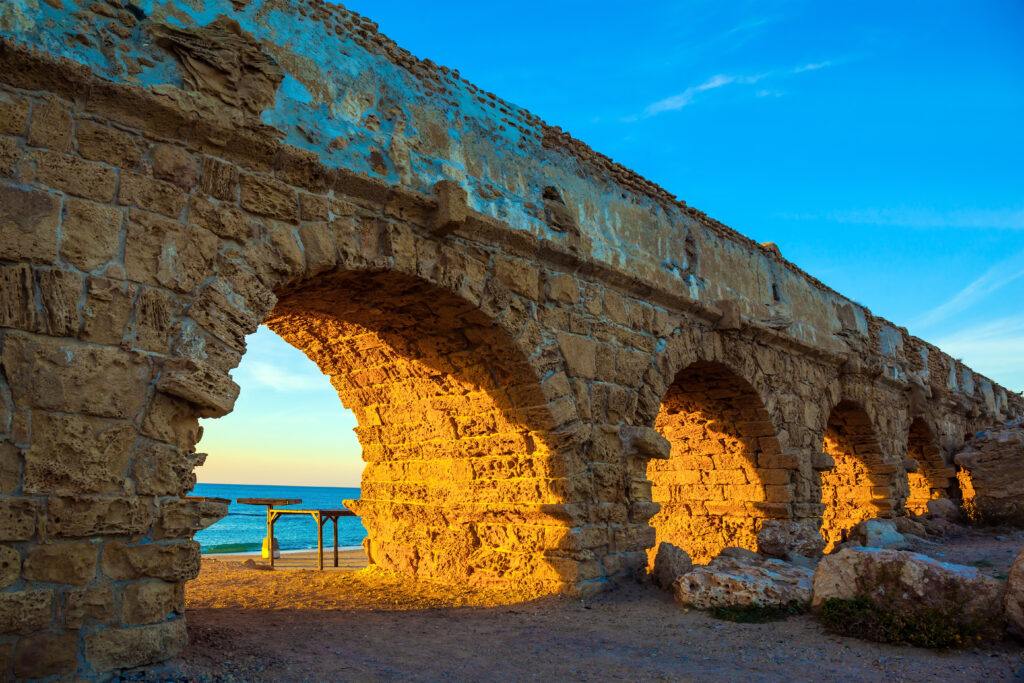
Adam Pažout, study co-author and archaeologist at the Autonomous University of Barcelona, noted that “the Romans left a huge impact with this road network,” which created the blueprint for many roads still in use today. Roman engineering—arched stone bridges, tunnels through hillsides, carefully graded paths—continues to shape the geography and economy of the Mediterranean region.
The discovery carries implications beyond archaeology. Understanding where Romans built their roads reveals patterns of ancient trade, military movement, and the spread of ideas. Brughmans noted that visualizing these ancient routes will provide a better understanding of historical trends, “including the rise of Christianity across the region and the spread of ancient outbreaks.”
The technological advances that made this discovery possible—satellite imagery, digitized aerial photographs, and computational archaeology—allowed researchers to play what Brughmans called “a massive game of connecting the dots on a continental scale.” When ancient accounts hinted at lost roads in certain areas, researchers analyzed terrain from above to spot traces invisible at ground level.
The new digital atlas and interactive map are now available online for scholars, teachers, and anyone interested in Roman history. The data transforms our picture of the ancient world from one dominated by major thoroughfares to a complex web of primary and secondary roads that bound the empire together. In ancient Judea, as throughout the Roman world, those roads didn’t just connect places. They connected people, goods, and ideas across a vast territory—an infrastructure whose remnants still guide travelers today.
The Digital Atlas of Ancient Roads can be viewed online.
The study titled “A high-resolution dataset of roads of the Roman Empire” can be read online.
